To celebrate Lucy's successful completion of her Phd, and to see her off before she heads back to Seattle, we biked from San Francisco (well, Salinas) to Los Angeles at the end of March, 2019. It was glorious!

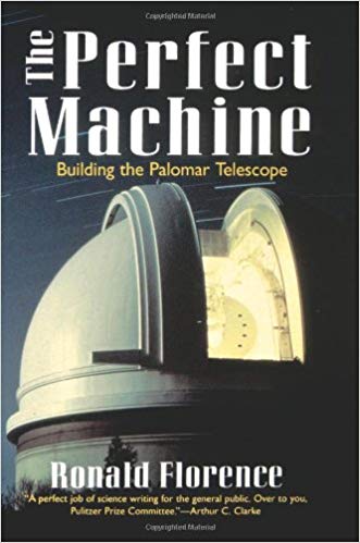
I grew an interest in the Palomar 200-inch telescope after Casey and Christine took me up to peek through the Mt. Wilson 100-inch telescope, and then reading "The Perfect Machine" about the construction of Palomar in the 1930s/1940s. Will ride up there someday!
We followed the classic Pacific Cost route, which follows Highway 1 along the coast most of the way from Canada to Mexico. We've made the trip down the Santa Cruz several times, and in 2017 did a credit-card tour down to Big Sur during a period when the highway was washed out (photos from that earlier trip). Originally we were hoping to bike the entire way from San Francisco to San Diego, with a ride up Palomar Mountain along the way. The logistics were a little too tight for a one-week trip though, so we cheated and took Amtrak down and started riding in Salinas (about 20 miles from Monterey, skipping 130 miles of riding), and terminated in Los Angeles. The entire trip was about 380 miles and 22,000ft elevation gain, and we took 6 days to ride. We rode fully-loaded touring bikes (we both have Surly Long-Haul Truckers), and mixed camping with a couple nights in motels. Lucy's write-up has GPS tracks and a day-by-day breakdown of the route, and I have more photos from this trip.
The Amtrak route from Oakland to Salinas goes past Moss Landing and the Elkhorn Slough, where I lived and worked (at MLML) in the summer of 2007. The dunes, strawberry fields, and power plant towers always bring back strong memories of that time, but I wasn't sad to miss the dangerous Highway 1 intersections in that area. Living in this area with no car meant I spent a lot of time biking and riding the bus through the fields to Castroville, Salinas, and Monterey to satisfy my boredom and catch longer distance transit routes to visit friends in the Bay Area.
After disembarking at the familiar sun-baked Salinas Amtrak station, we rode a short 20-something miles through a former military base until we hit the big dune bike paths on Monterey Bay and rolled into Monterey itself. It was nice to have a short first day to shake out any equipment issues and warm our legs up: both of us had done work on our bikes just before this trip, and we had to get used to such heavy loads.


The next day, the first day of real riding, is one of the most scenic stretches of the entire coast. We started with a detour along 17-mile drive around Carmel point, which despite the plutocratic estates and luxury golf courses is one of my favorite stretches of riding anywhere. We split a burrito near Pfeiffer Big Sur park and packed a second for the road; we ate that one right around the 54 mile mark, which speaks to the precision of my "53 Miles Per Burrito" t-shirt.
The entire stretch around Big Sur (from Carmel down to Moro Bay or so) is relatively isolated with few or no overland routes over the Coastal Range. The coast is rugged and hilly; the road is either a feat of engineering or a total boondoggle, depending on how you look at it. There were a number of construction projects along the way, and the road washes out frequently. We were riding on a Sunday and Monday, and traffic was mild and considerate both days, with construction trailers in particular giving us wide berth on the road. I was worried about lack of supplies or water, but there were more little ice cream shops and restaurants along this strip than I expected (though it didn't feel over-developed at all).


We stayed at our first hiker-biker campsite of the trip, and finally got to experience the joys of sharing a campsite with other long-distance riders. I've always been guilty of being a campground introvert and wishing I had more privacy and solitude in that weird American outdoors kind of way, but it turns out bike tourists are wonderful people and we share an obvious obsession with biking, an antipathy for cars that drive too close, and curiosity for side-adventures and secret tricks. After bonding with our camp-mates by biking back a couple miles to fetch potable water from another campground (ours had none!), we got lunch tips from two young women who used to live in the area, and checked out the Brompton being ridden by a Swiss gentleman (one half of a daughter/father pair).


After passing Hearst Castle, we started slowly re-entering denser civilization, passing the beach town of Cayucos and finally Moro Bay. I drove to Hearst Castle once many years ago with friends, but neither Lucy nor I had ever been south of there through LA. Moro bay was an unexpected delight: the huge rock is surreal, like a fantasy novel, and the hiker-biker campsite in town was a delight, with hot showers and a generous area to ourselves under giant Eucalyptus.


It was amazing to perceive the climate and ecosystem change as we traveled south under our own power and realize we were traversing an entire bioregion. After the cool fog and redwoods of the Big Sur coast (North California by climate if not geography), we were well into the Central region at this point, and started seeing signs of Southern California. The first oil derrick I noticed was around Guadalupe, the in-town roads got wider, the RV parks larger and more frequent, and the palm trees seemed more and more believable. We didn't catch sight of any zebras around Hearst Castle, but we did pass an Ostrich farm closer to Santa Barbara (exotic animals: check). And we knew we'd finally arrived when the density of giant concrete flood control structures reached a crescendo.

The stretch from Moro Bay through San Louis Osbismo was mostly in-land. Parts felt just like Marin County, with rolling bare green hills; the ~20 miles section off Highway 1 just south of Moro Bay was especially nice. We had a quick stop in SLO to get a beer at Libertine Brewing, which somewhat symbolized that we were hitting a rhythm on the road and didn't need to rush through every town. It would have been nice to stop longer at a few places: we were riding relatively early in the season, which meant the days were still short. On the flip side, traffic was less and it didn't get too hot (it was sunny and warm enough already on most of the climbs).
The stretch from Guadalupe to Lompoc was industrial agriculture. The road got quite narrow at some points, which made managing bi-directional traffic of large trucks nerve-wracking. We also had our biggest stretch of proper freeway riding along 101 here, with some exciting exit by-passing at highway speeds. I also took us on a bad shortcut up a very steep (but short) hill on the section; sorry Lucy! Made it through alright, and there was a nice gentle hill just before Lompoc with almost no traffic. We met two German hippies there picking a wild camping site. They were biking south-to-north all the way to Vancouver, which is generally not advisable (north-to-south has a lot of advantages), but they had a lot of time and didn't want to be biking in the north in early Spring. It was fun to meet someone going the opposite direction, because we had a lot more advice and tips to trade; it was also weird to be able to give detailed advice about the Pacific Northwest, which they were months away from.
We took an alternate route from Lompoc to Santa Barbara, via Solvang, which added elevation but skipped a long freeway stretch, which was the right decision. We had been worried about the rain forecast the entire trip, and we did get rained on a bit camping just outside Lompoc, but it was not much more than a drizzle and we were well prepared for riding in the rain. Solvang is a Disneyland-like replica Danish town, which reminded us of "Bavarian" Leavenworth, WA.


We saw beautiful flowers almost the entire trip, but they really took off here. Beautiful orange poppies (the state flower), bright neon purple ground flowers of some type, and whole hillsides quilted in different shades of yellow. The climb before Santa Barbara wasn't big by our usual road biking standards, and had a totally reasonable grade the whole way, but with our loads and in the dry heat it "got our attention". Didn't quite turn in to a grind though, and the decent down the back into SoCal proper was fast and fun.
Neither of us had been to Santa Barbara before. It's a bit sprawling, but overall smaller and more luxury/high-end than I expected. The backing mountains, channel islands, and white-washed downtown were beautiful. The offshore oil rigs made me feel like we were in a whole different state or country, which we sort of were.


In retrospect, it's amazing how much ground we covered in the last day of riding, from Santa Barbara through Malibu to Los Angeles (odometer read over 90 miles at the end of the day). Most of the riding was on 1 along the coast, but we also went through Ventura and Port Hueneme (a huge sprawling military installation). I got the only flat either of us experienced on the whole trip on this stretch.
The last stretch through Maliby (starting around Point Dume until the Santa Monica bike path) was some of the tightest and least pleasant riding of the trip: fast, multi-lane commuter traffic, with waste bins and parked cars in the shoulder. We had a wonderful surprise when the daughter/father pair we met earlier spotted us and pulled over in a car to say hello. They had ended their ride in SLO and were going to explore LA before driving back to SF to catch return flights home; a crazy coincidence that we crossed paths on the last ~10 miles or so of our ride. A nice flat, fast, flowery day overall though. It would be reasonable to cut the ride off at Santa Barbara (where there is an Amtrak station), but I'm glad we did the final stretch at least once.

We pulled in to the Santa Monica bike path and got to the boardwalk and Venice Beach well before the sun came down. Lucy described the beach as feeling like the whole thing was fake and concrete underneath, which I think is funny and reasonably accurate, but I didn't mind it. The slow curves with lots of other scooters and weird bikes was a nice wind-down for the day. We looped around the Venice scene for a bit, and considered riding more through the city to our downtown motel, but changed our mind after just a few blocks. There was probably a decent bike path to follow, but after a long ride we can hit a wall very fast, and it's no fun weaving in traffic and getting lost when you're tired and hungry. We caught the actual sunset back on the beach just in time, then took light rail (which was great) from Santa Monica to Union Station downtown, where we stayed in a motel.


In the morning we walked through Chinatown, then spent the day visiting friends and their baby Yoshi. I'm already looking forward to visiting again, and maybe taking additional rides to Palomar, hikes in the San Gabriels, and exploring routes east to the desert and Arizona.
The next day we boarded the Coast Starlight Amtrak from Union Station, loading our bikes and panniers on just in time. In addition to being the Kingdom of the Car, California has some of the best rail routes in the country, and Union Station is a grand and well-maintained monument to rail travel. It is so pleasant to be able to roll our bikes literally right on to the platform and just pass them up into the baggage car without disassembly or boxing. The rail tracks back paralleled our bike route about half the time, which was fun for remembering specific spots and stretches. The stretch north of Santa Barbara continues along the coast (where highway 1 is inland), so we got to see that, and we got to see a bunch of the Vandenberg air force base that we wouldn't have otherwise. I had assumed that the tracks would head up through the Central Valley further north, but they continue to wiggle around through the Coastal Range until popping out at Salinas. A pretty ride in the viewing lounge the whole 11 hours to Oakland.

